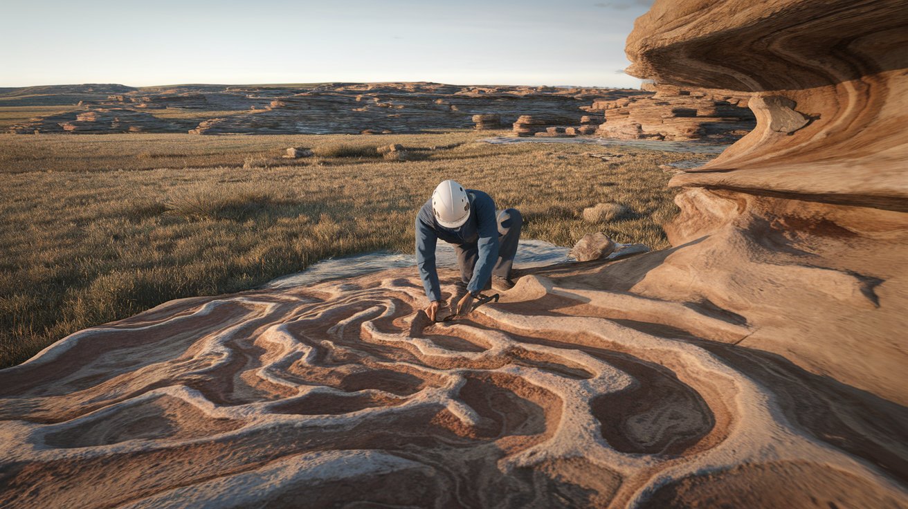
What Does a Geomorphologist Study? Complete Field Guide 2025
A geomorphologist studies landforms and surface processes that shape Earth’s physical landscape over time. These scientists examine how mountains, valleys, rivers, and coastlines form and change through natural forces like erosion, weathering, and tectonic activity. Geomorphologists combine fieldwork, laboratory analysis, and advanced technology to understand landscape evolution and predict future changes in our environment.
Core Areas of Geomorphological Study
Geomorphology encompasses multiple specialized fields that focus on different aspects of Earth’s surface processes. The discipline integrates physical geography, geology, hydrology, and climatology to provide comprehensive understanding of landscape formation. Modern geomorphologists utilize cutting-edge technology including LiDAR scanning, satellite imagery, and geographic information systems (GIS) to analyze surface changes with unprecedented precision.
The field has evolved significantly since its establishment in the late 19th century, with contemporary researchers addressing critical issues like climate change impacts on coastal erosion and urban development effects on natural drainage systems. Current geomorphological research directly supports environmental management, disaster preparedness, and sustainable land use planning across the United States.
Fluvial Geomorphology and River Systems
Fluvial geomorphologists study river systems and water-carved landscapes including stream channels, floodplains, and watershed dynamics. They analyze how flowing water shapes valleys, creates meanders, and deposits sediment across different geological timescales. This research is particularly crucial in the United States where flood management along major rivers like the Mississippi, Colorado, and Columbia directly affects millions of residents and billions of dollars in infrastructure.
Coastal and Marine Geomorphology
Coastal geomorphologists examine shoreline processes including wave action, tidal effects, and sea-level changes that continuously reshape America’s extensive coastlines. With over 95,000 miles of coastline, the United States faces significant challenges from coastal erosion, with economic losses exceeding $500 million annually. These specialists study beach formation, cliff retreat, and barrier island migration to inform coastal protection strategies and climate adaptation planning.
Glacial and Periglacial Processes
Glacial geomorphologists focus on ice-related landscape formation including glacier movement, moraine deposits, and permafrost dynamics. In Alaska and the northern states, this research addresses critical infrastructure stability issues as climate change accelerates glacial retreat and permafrost thaw. Current studies indicate that Alaska’s glaciers are retreating at rates of 1-3 feet per year, fundamentally altering regional hydrology and ecosystem dynamics.
Research Methods and Tools in Geomorphology
Modern geomorphological research employs sophisticated methodologies combining traditional field techniques with advanced technological tools. Scientists collect sediment samples, measure erosion rates, and document landscape changes through systematic observation and data analysis. The integration of remote sensing technology has revolutionized the field, enabling researchers to monitor large-scale processes across entire watersheds and mountain ranges simultaneously.
Field instrumentation includes stream gauges, weather stations, and automated sediment samplers that provide continuous data collection over extended periods. Laboratory analysis techniques such as particle size analysis, radiocarbon dating, and geochemical testing help determine the age and composition of geological materials, revealing the timing and intensity of past landscape-forming events.
Remote Sensing and GIS Applications
Remote sensing technology enables geomorphologists to analyze landscape changes across vast spatial scales using satellite imagery, aerial photography, and LiDAR data. Geographic Information Systems (GIS) facilitate complex spatial analysis, allowing researchers to model erosion patterns, predict landslide susceptibility, and assess watershed health. The United States Geological Survey operates extensive monitoring networks that provide essential data for geomorphological research nationwide.
Fieldwork and Data Collection Techniques
Fieldwork remains fundamental to geomorphological study as direct observation and measurement provide ground-truth data essential for validating remote sensing analyses. Researchers conduct topographic surveys, collect rock and sediment samples, and install monitoring equipment to track processes like soil erosion, channel migration, and slope stability. Field campaigns often involve interdisciplinary teams working in challenging environments from desert canyons to arctic tundra.
Climate Change Impact on Landform Evolution
Climate change significantly accelerates geomorphological processes across the United States, with documented increases in extreme precipitation events, temperature fluctuations, and storm intensity affecting landscape stability. Rising temperatures alter freeze-thaw cycles in mountainous regions, increasing rockfall frequency and modifying slope processes. Coastal areas experience accelerated erosion due to sea-level rise and more intense storm surges, requiring immediate adaptation strategies.
Recent studies indicate that precipitation pattern changes are fundamentally altering river discharge patterns, with some regions experiencing increased flooding while others face prolonged drought conditions. These shifts affect sediment transport, channel morphology, and riparian ecosystem health across major river systems including the Colorado River Basin and Great Lakes watersheds.
Applications in Environmental Management
Geomorphological research directly supports environmental management initiatives including habitat restoration, erosion control, and natural disaster mitigation. Land managers rely on geomorphological assessments to design effective restoration projects that work with natural processes rather than against them. This approach proves more cost-effective and sustainable than traditional engineering solutions, with success stories documented across national parks, wildlife refuges, and urban watersheds.
Federal agencies including the Environmental Protection Agency, National Park Service, and Army Corps of Engineers integrate geomorphological principles into policy development and project implementation. Current applications include stream restoration projects worth over $1 billion annually, coastal resilience planning, and sustainable agriculture practices that minimize soil erosion and protect water quality.
Natural Hazard Assessment and Mitigation
Geomorphologists play crucial roles in natural hazard assessment by identifying areas susceptible to landslides, floods, and coastal erosion. Their research informs building codes, zoning regulations, and emergency preparedness planning in vulnerable communities. The National Landslide Hazards Program, managed by USGS, relies heavily on geomorphological expertise to map hazard zones and develop early warning systems protecting lives and property.
Ecosystem Restoration and Conservation
Ecosystem restoration projects incorporate geomorphological principles to ensure long-term success and ecological functionality. Wetland restoration, stream rehabilitation, and coastal dune reconstruction all require detailed understanding of natural processes and landform development. The Great Lakes Restoration Initiative has invested over $3.5 billion in projects guided by geomorphological research, demonstrating the practical value of this scientific discipline.
Career Opportunities and Educational Pathways
Career opportunities for geomorphologists span academic institutions, government agencies, environmental consulting firms, and natural resource management organizations. The Bureau of Labor Statistics projects steady growth in geoscience occupations, with median salaries ranging from $92,000 for entry-level positions to $150,000 for senior specialists in 2024. Federal agencies offer competitive positions with comprehensive benefits and opportunities for field research.
Educational pathways typically begin with undergraduate degrees in geology, geography, or environmental science followed by specialized graduate training in geomorphology. Leading programs at institutions like University of Colorado Boulder, Arizona State University, and University of Washington provide hands-on research experience and access to cutting-edge analytical facilities. Professional certification through organizations like the American Institute of Professional Geologists enhances career prospects.
Interdisciplinary Connections and Future Directions
Geomorphology increasingly integrates with other scientific disciplines including hydrology, ecology, atmospheric science, and engineering to address complex environmental challenges. This interdisciplinary approach enables comprehensive understanding of Earth system interactions and supports development of holistic management strategies. Emerging research areas include urban geomorphology, planetary geomorphology, and biogeomorphology that examine biological influences on landscape evolution.
Future research priorities focus on quantifying human impacts on geomorphological processes and developing predictive models for landscape change under various climate scenarios. Advanced technologies including artificial intelligence, machine learning, and autonomous sensor networks promise to revolutionize data collection and analysis capabilities, enabling more precise monitoring and prediction of landscape dynamics across multiple temporal and spatial scales.
Related video about what does a geomorphologist study
This video complements the article information with a practical visual demonstration.
What you should know
What education is required to become a geomorphologist?
A geomorphologist typically needs at least a bachelor’s degree in geology, geography, or environmental science, followed by a master’s or doctoral degree specializing in geomorphology. Coursework includes physical geography, geology, hydrology, statistics, and GIS. Many positions require field experience and research skills developed through graduate programs at accredited universities.
How much do geomorphologists earn in the United States?
According to 2024 data, geomorphologists in the United States earn median salaries between $65,000-$95,000 for entry-level positions, $85,000-$120,000 for mid-career professionals, and $120,000-$160,000 for senior specialists. Federal government positions often offer higher compensation with comprehensive benefits packages and opportunities for advancement.
What tools do geomorphologists use in their research?
Geomorphologists use diverse tools including GPS units, total stations for surveying, sediment samplers, stream gauges, and weather monitoring equipment. Advanced technologies include LiDAR scanning, satellite imagery, ground-penetrating radar, and GIS software for spatial analysis. Laboratory equipment includes particle size analyzers, microscopes, and dating equipment for determining ages of geological materials.
How does climate change affect geomorphological processes?
Climate change accelerates many geomorphological processes by increasing precipitation intensity, altering temperature patterns, and raising sea levels. These changes intensify erosion, modify river flows, accelerate coastal retreat, and destabilize permafrost regions. Geomorphologists document these impacts and develop adaptation strategies for affected communities and ecosystems.
Where do geomorphologists typically work?
Geomorphologists work in universities conducting research and teaching, government agencies like USGS and NOAA, environmental consulting firms, national parks, and engineering companies. Many positions involve both office analysis and extensive fieldwork in diverse environments from deserts to mountain ranges, requiring physical fitness and outdoor skills.
What is the difference between geomorphology and geology?
Geomorphology focuses specifically on Earth’s surface processes and landform development, while geology encompasses the entire planet including internal structure, rock formation, and subsurface processes. Geomorphologists emphasize current and recent landscape-shaping processes, whereas geologists study Earth’s complete geological history spanning billions of years. Both fields overlap significantly and complement each other.
| Study Area | Key Processes | Practical Applications |
|---|---|---|
| Fluvial Systems | Stream erosion, sediment transport, channel migration | Flood management, habitat restoration |
| Coastal Processes | Wave action, tidal effects, sea-level change | Erosion control, coastal protection |
| Glacial Dynamics | Ice movement, moraine formation, permafrost | Climate research, infrastructure planning |
| Slope Processes | Mass wasting, weathering, soil formation | Landslide hazard assessment |