Basic Geography Terms: Essential Vocabulary Guide 2025
Understanding basic geography terms is fundamental for students, educators, and anyone seeking to comprehend our world’s physical and human features. This comprehensive guide explores essential geographic vocabulary, from landforms and climate patterns to population dynamics and spatial relationships that shape our planet in 2025.
Physical Geography Fundamentals
Physical geography encompasses the study of Earth’s natural features and processes. Landforms represent the most visible aspects of physical geography, including mountains, valleys, plains, and plateaus that define regional landscapes. These features result from geological processes occurring over millions of years, creating the diverse topography we observe across the United States today.
Elevation measures the height of land above sea level, significantly impacting climate, vegetation, and human settlement patterns. In the United States, elevation ranges from Death Valley at 282 feet below sea level to Denali’s peak at 20,310 feet above sea level, demonstrating extreme topographical diversity within a single nation.
Major Landform Categories
Mountains are elevated landforms rising prominently above surrounding terrain, typically formed through tectonic plate movement or volcanic activity. The Rocky Mountains stretch over 3,000 miles across North America, while the Appalachian Mountains extend approximately 2,000 miles along the eastern United States, showcasing different geological formation processes and ages.
Water Features and Hydrology
Rivers are flowing bodies of water that drain watersheds and transport sediments to larger water bodies. The Mississippi River system drains approximately 40% of the continental United States, demonstrating how water features connect diverse geographic regions. Lakes are standing water bodies formed through various processes, with the Great Lakes containing about 20% of the world’s fresh surface water.
Climate and Weather Terminology
Climate represents long-term weather patterns in specific regions, while weather describes short-term atmospheric conditions. Understanding this distinction helps explain why Phoenix, Arizona maintains a desert climate despite occasional rainfall, or why Seattle experiences a marine west coast climate characterized by mild, wet winters and dry summers.
Precipitation includes all forms of water falling from the atmosphere, including rain, snow, sleet, and hail. Annual precipitation varies dramatically across the United States, from less than 4 inches in parts of Nevada to over 400 inches in some Hawaiian locations, illustrating geographic diversity in water availability.
Temperature Patterns
Temperature zones are regions characterized by similar thermal conditions throughout the year. The United States spans multiple temperature zones, from Arctic conditions in northern Alaska to tropical climates in southern Florida and Hawaii. These variations result from latitude, altitude, proximity to water bodies, and prevailing wind patterns.
Seasonal Weather Cycles
Seasons result from Earth’s axial tilt and orbital position relative to the sun, creating predictable patterns of temperature and daylight duration. In temperate regions of the United States, four distinct seasons occur, while tropical areas like Hawaii experience only wet and dry seasons, demonstrating how geographic location influences seasonal patterns.
Human Geography Essentials
Human geography examines the relationship between people and places, focusing on how humans organize space and interact with their environment. Population density measures the number of people per unit area, varying dramatically across the United States from over 27,000 people per square mile in Manhattan to fewer than one person per square mile in parts of Alaska.
Urbanization describes the process of population concentration in cities and towns, with approximately 83% of Americans living in urban areas as of 2025. This trend reflects economic opportunities, infrastructure development, and changing lifestyle preferences that continue shaping American settlement patterns.
Spatial Relationships and Location
Absolute location provides exact coordinates using latitude and longitude, while relative location describes position in relation to other places. For example, Denver’s absolute location is 39.7392°N, 104.9903°W, while its relative location is in the western United States, east of the Rocky Mountains, and approximately 600 miles west of Kansas City.
Scale in geography refers to the relationship between distance on a map and actual distance on Earth’s surface. Understanding scale helps interpret maps accurately, whether examining a detailed city street map at 1:10,000 scale or a continental map at 1:50,000,000 scale.
Coordinate Systems
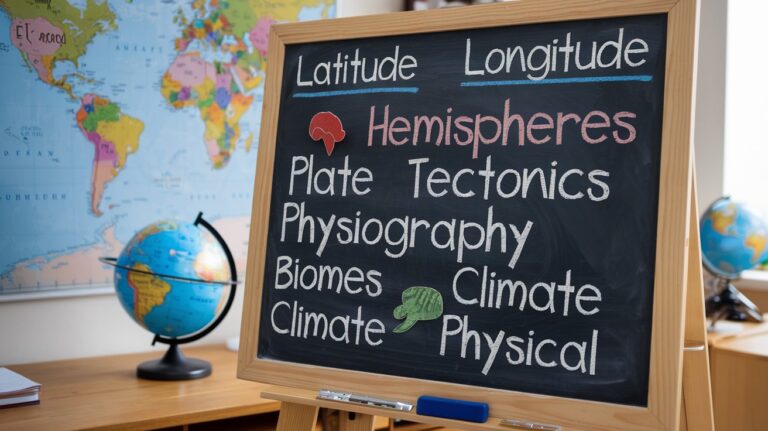
The latitude and longitude system provides a global grid for precise location identification. Latitude lines run east-west and measure distance north or south from the equator, while longitude lines run north-south and measure distance east or west from the Prime Meridian. This system enables GPS navigation and accurate mapping worldwide.
Directional Concepts
Cardinal directions include north, south, east, and west, while intermediate directions are northeast, northwest, southeast, and southwest. These directional concepts are fundamental for navigation, weather reporting, and describing geographic relationships between locations.
Economic Geography Terms
Natural resources are materials from the environment that humans use for economic purposes, including renewable resources like forests and water, and non-renewable resources like oil and minerals. The United States possesses diverse natural resources, from timber in the Pacific Northwest to petroleum reserves in Texas and Alaska, supporting various economic activities.
Agriculture represents the cultivation of crops and raising of livestock, with different regions specializing in specific agricultural products based on climate, soil, and topography. The Great Plains serve as America’s breadbasket, producing wheat and corn, while California’s Central Valley generates diverse fruits and vegetables year-round.
Environmental Geography Concepts
Ecosystem refers to the interaction between living organisms and their physical environment within specific areas. The United States contains diverse ecosystems, from Arctic tundra in Alaska to desert ecosystems in the Southwest, each supporting unique plant and animal communities adapted to local conditions.
Biome describes large-scale ecosystems characterized by distinctive plant communities and climate conditions. Major biomes in the United States include temperate deciduous forests in the East, grasslands in the Great Plains, coniferous forests in the North and mountain regions, and deserts in the Southwest.
Conservation and Sustainability
Conservation involves protecting and preserving natural resources and environments for future generations. The National Park Service manages 423 areas covering over 85 million acres, demonstrating America’s commitment to preserving significant landscapes and ecosystems for scientific study, recreation, and education.
Environmental Challenges
Climate change represents long-term shifts in global temperature patterns and weather systems, affecting ecosystems, agriculture, and human settlements worldwide. Rising sea levels threaten coastal communities, while changing precipitation patterns impact water resources and agricultural productivity across different regions of the United States.
Cultural Geography Vocabulary
Culture encompasses the beliefs, customs, practices, and social behaviors of human groups, varying significantly across geographic regions. Cultural geography examines how culture influences landscape use, architectural styles, food systems, and social organization in different places.
Cultural diffusion describes how cultural traits spread from one location to another through migration, trade, communication, and other forms of human interaction. The spread of technology, languages, religions, and customs demonstrates ongoing cultural diffusion processes in our interconnected world.
Transportation and Infrastructure Terms
Transportation networks include systems of roads, railways, waterways, and airways that enable movement of people and goods between locations. The Interstate Highway System spans approximately 48,000 miles across the United States, facilitating commerce and travel while influencing settlement patterns and economic development.
Infrastructure refers to basic physical and organizational structures needed for society to function, including transportation systems, communication networks, water and sewer systems, and power grids. Quality infrastructure supports economic growth and improves quality of life for residents in different geographic regions.
Related video about basic geography terms
This video complements the article information with a practical visual demonstration.
FAQ – Common Questions
What are the most important basic geography terms every student should know?
Essential basic geography terms include landforms (mountains, plains, valleys), climate and weather, latitude and longitude, population density, natural resources, and ecosystems. These fundamental concepts provide the foundation for understanding Earth’s physical features, human settlement patterns, and environmental relationships.
How do physical geography terms differ from human geography terms?
Physical geography terms describe Earth’s natural features like mountains, rivers, climate, and ecosystems, while human geography terms focus on people and their activities, including population, culture, cities, and economic systems. Both categories interact to explain how humans adapt to and modify their environments.
Why is understanding geographic terminology important in 2025?
Geographic terminology helps people understand global challenges like climate change, resource distribution, migration patterns, and environmental conservation. In our interconnected world, geographic literacy enables informed decision-making about sustainability, economic development, and social issues affecting communities worldwide.
What’s the difference between absolute and relative location?
Absolute location provides exact coordinates using latitude and longitude measurements, giving precise geographic positions. Relative location describes where something is in relation to other known places or landmarks, such as saying Denver is east of the Rocky Mountains or north of Colorado Springs.
How do climate and weather terms relate to each other?
Weather describes short-term atmospheric conditions like daily temperature and precipitation, while climate represents long-term patterns of weather in specific regions over decades. Understanding both helps explain why places have consistent seasonal patterns while experiencing daily weather variations.
What role do natural resources play in geographic understanding?
Natural resources influence where people settle, what economic activities develop, and how regions interact through trade. Understanding resource distribution helps explain population patterns, economic development, and environmental challenges facing different geographic areas in the United States and globally.
| Geography Category | Key Terms | Learning Benefit |
|---|---|---|
| Physical Geography | Landforms, climate, elevation, rivers | Understanding natural world structure |
| Human Geography | Population, urbanization, culture | Analyzing human-environment interaction |
| Spatial Concepts | Location, scale, direction | Navigation and mapping skills |
| Environmental Terms | Ecosystem, biome, conservation | Environmental awareness and stewardship |